Monday, March 12, 2018

Five Ways to Describe Rocks - Part 2


After Bryce we drove into Dixie National Forest and Grand Staircase Escalante National Monument. Highway 12 is a scenic by-way. Scenic indeed!  It took a good 3 hours to drive the 83 miles from Bryce to Grover near Capital Reef National Park.  Turns and twists, 30-45 mph, up and down.  The highest pass, Homestead Pass, was 9,600 feet. The Siesta thermometer read 18 degrees.  At one point I saw 3 elk off the road a bit standing in the pine forest. Eighty-three miles of ever-changing rock formations and vegetation, depending on elevation, from scrubby desert bristle bush to red-stemmed shrubs along dry creek beds to cedars and aspens all backdropped by colorfully layered buttes and bluffs.

And then we spent a night at Capital Reef National Park, the unfamiliar one, at least to me, and maybe to others, too, as there were only 3 other camp sites occupied in the campground. This park is a 100 - mile north to south stretch of protected land that a few million years ago experienced a shift in the earth’s plates causing an up thrust of rock formations. Many of the giant buttes of red rock striated with tans and grays, “pleat” at the bases to form rock “folds.” HooDoos caused by erosion are present, too. Only a small northern section of the 100 -mile “wrinkle” is developed with a Visitor’s Center, the campground and an 8- mile scenic drive that takes you past the monumental red bluffs and ends in gravel meandering down as the canyon narrows.  The walls of rock close in until you must look straight up to see their height.

Finally, we turned east on I-70, the ‘real’ start to our long trip back to Michigan. Except for the detour we made 60 miles later to Arches National Park, near Moab, Utah. How could we pass it up? Gorgeous sunshine and a beautiful blue sky framed our drive through this park of crazy rock formations that with a little imagination turn into Egyptian pharaohs, elephants, sheep, and courthouses. And then there are the arches!!

Our last night of camping before heading over the Rockies and home was Monument Campground on the Colorado River near Fruita, CO, part of James E. Robb State Park, just west of Grand Junction. After that we drove hard for two long days, making our midnight arrival at 314 N Clubview a huge relief and oh, so sweet.
Arches National Park


Escalante National Monument

Five Ways to Describe Rocks - Part 1


From Death Valley, CA, we drove into Nevada and through the north side of Las Vegas to get on I-15. East of the city we took the exit for Valley of Fire State Park which is adjacent to the large complex of Lake Meade National Rec Area. After driving 18 miles through a nothing-but-bristle- bush desert landscape, the sudden downturn of the road into a valley of brilliantly red rock walls and monoliths was nothing short of breathtaking. The campsites were tucked beside and under the red rock buttes. The next morning, we drove the scenic loops through the rest of the park and saw the extent of the fiery valley.  Every color of brown, red, orange and purple was layered in the rock formations.

The next day we drove into Utah and Zion National Park where the massive walls of rock that border the Virgin River are so majestic and so awe-inspiring that when I ran out of “Wow” and “Holy Cow,” I smoothed out into a steady “om.” We snagged one of the last available camp sites at South Campground. Watchman Campground was already full when we arrived – at 2:30 in the afternoon! Even after it snowed during the night (one of only 5 or 6 times a year it snows at street level in the park, according to our bus driver) and we decided not to hike in the 34 degrees on slippery trails, our ride through the canyon on the shuttle bus gave us a good taste of the glory of this national park.

If you drive anything bigger than a car and you want to take the road east out of Zion, you must buy a permit to go through the 1930s-built tunnel, which we did. Then tunnel traffic from both directions is stopped and you can drive safely through alone. Once through, we drove north and east on roads that were just a bit snowy at higher elevations until we got to the entrance of Bryce National Park, where there was quite a bit of old as well as new snow. Plus, it was cold at 7000 feet. We shopped at the Visitor’s Center, and we stopped and marveled at the depth of Sunset Canyon with all its rows and groupings of HooDoos (columns.) The word HooDoo comes from a similar sounding Paiute word meaning scary, which they may well look in the dark under a full moon, but in the sunshine, under a blue sky, those rock HooDoos looked rather cheerful, I thought. (cont.)
Valley of Fire

                                                         Zion National Park


Bryce National Park


Saturday, March 10, 2018

The Places We've Been


Oh, the miles we've covered and the places we've been!
After leaving Annie's in Sacramento, Pinnacles National Park east of San Jose was our first stop.  We hiked the Condor Gulch trail and saw 5 condors perched on a pinnacle.  The park has been one of a few release areas for condors raised in captivity and 27 condors now wear tags from Pinnacles National Park. Pinnacles: just one of the names for those free-standing columns of stone that you find in various rocky places in the West.

Just so we could say we'd been coast to coast, Atlantic to Pacific, on this trip, we decided to head to the beach before turning east for home. South of Monterey, CA, we found a camp site at San Simeon State Park, just north of Cambria. A short drive from there is the state park beach where dogs can walk on leash. Our walk with Nina ended abruptly, though, when we realized the large brown lump in the sand ahead of us was a sleeping bull elephant seal. We decided not to go any closer. Up the coast a few miles, though, we watched from a viewpoint, tons of elephant seals lounging in the sand.

 Leaving San Simeon, we drove Hwy 46 toward Bakersfield, CA. On that road, we found Blackwell Corners, a gas station at an intersection. This was where James Dean stopped for gas in 1955 before his fatal car accident a short time later. The gas station that's there now, of course, is new, and includes a market and a gift shop to attract passing motorists. Just as interesting, though, was the valley that Hwy 46 crosses. This vast stretch of flatness grows more almond and pistachio trees than my mind could comprehend. Of course we bought pistachios at the James Dean Market.


That night we bumped ever-so-slowly over 5 miles of washboardy gravel to Trona Pinnacles National Rec Area. Otherworldly comes to mind. There, more than 500 rock columns (or tufa spines) of various sizes rise from a flat valley of nothingness (well, nothing but rocks, anyway.) Since the Rec Area is so off the beaten path, we had the place to ourselves, except for one local amateur photographer who was setting up his tripod to capture that evening's full moon rise.  And oh, what an event that was! The next morning we caught the sunrise AND the moonset.

From there, we drove north and east to the entrance of Death Valley National Park.  As it turned out, a favorite part of that morning drive was the road BEFORE we reached the west entrance of Death Valley Park. We passed Searles Valley, a dry lakebed that contains 98 of the 104 known naturally occurring chemical elements. Searles Valley Minerals mines and processes minerals from this expansive flatland to produce boric acid, among other things. The town of Trona IS the mine and processing facility, plus a few houses. Wikipedia says, "Searles Valley is known for its isolation and desolation." Uhh.... yes. The amazing part of the drive happened after that. We drove from that very very flat lowland of Searle Valley Basin, until the road got to a point where it turned down sharply, curving and twisting to an even lower valley that stretched for miles to the east and north between two mountain ranges. A breathtaking moment! The occasional sunshine  through the clouds over the mountains and through the light mist that was falling created  rainbows as we drove along through this enchanted area.


Then we entered Death Valley National Park. As the sun got higher in the sky, the wind ramped up, and by the time we'd climbed over the mountains on the west side of the park and tumbled down into the sandy valley that sits below sea level on the east side, the wind was gusting to 50 mph, and we decided not to stick around in the swirling cloud of sand. So our plan to camp in Death Valley died, and instead we battled the Siesta down the windy road toward Nevada.


Monday, February 26, 2018

Sac Town


Tower Bridge
Annie's house
It’s Monday. Tomorrow Annie will go back to work after taking a day off on either side of the weekend. That gave us 4 days together besides last weekend’s three days.

And so tomorrow we will more than likely leave, too, heading east, to begin our trek back to Michigan.  We’ll leave if we can.  It’s raining this morning in Sacramento – a good solid kind of rain – and the forecast calls for rain all day and evening.  That will mean snow in the Sierras, the mountains we have to cross on I-80 at Donner Pass, Lake Tahoe, if we want to then drive south on the eastern side of the mountain range. Which we do. Even though the miles and miles of almond, apricot and peach trees are blooming right now in the Central Valley, we have driven I-5 before and would like to take a different route. So our leaving tomorrow and going east will depend on the snow accumulation today and tonight. We shall see.

Above the American River
Annie at USGS
Our stay with Annie has been delightful.  We have visited her at the USGS office on the Sac State campus to see her work space and meet some of her colleagues, we’ve toured Old Town Sacramento, strolled through the Crocker Art Museum, and walked the dogs on the American River trail more than once. We visited two of my cousins (Mom’s sister’s family,) one of whom happens to live a few miles north of Annie in this sprawling city, and we’ve gazed with incredulous Michigan eyes on the bounty of winter vegetables and citrus at the Sunday Sacramento Farmer’s Market. We snagged a good deal on Cara Cara oranges. Of course, Michael helped Annie complete a few projects on her cute little house she’s owned for three months. Installing a garage door opener and blowing 12 inches of insulation into the attic were the two big ones on the To-Do list. Done!!

Saturday, February 17, 2018

Birds, Cacti and Rocks

    My favorite thing to do at Patagonia Lake State Park in southern Arizona is stand around on the
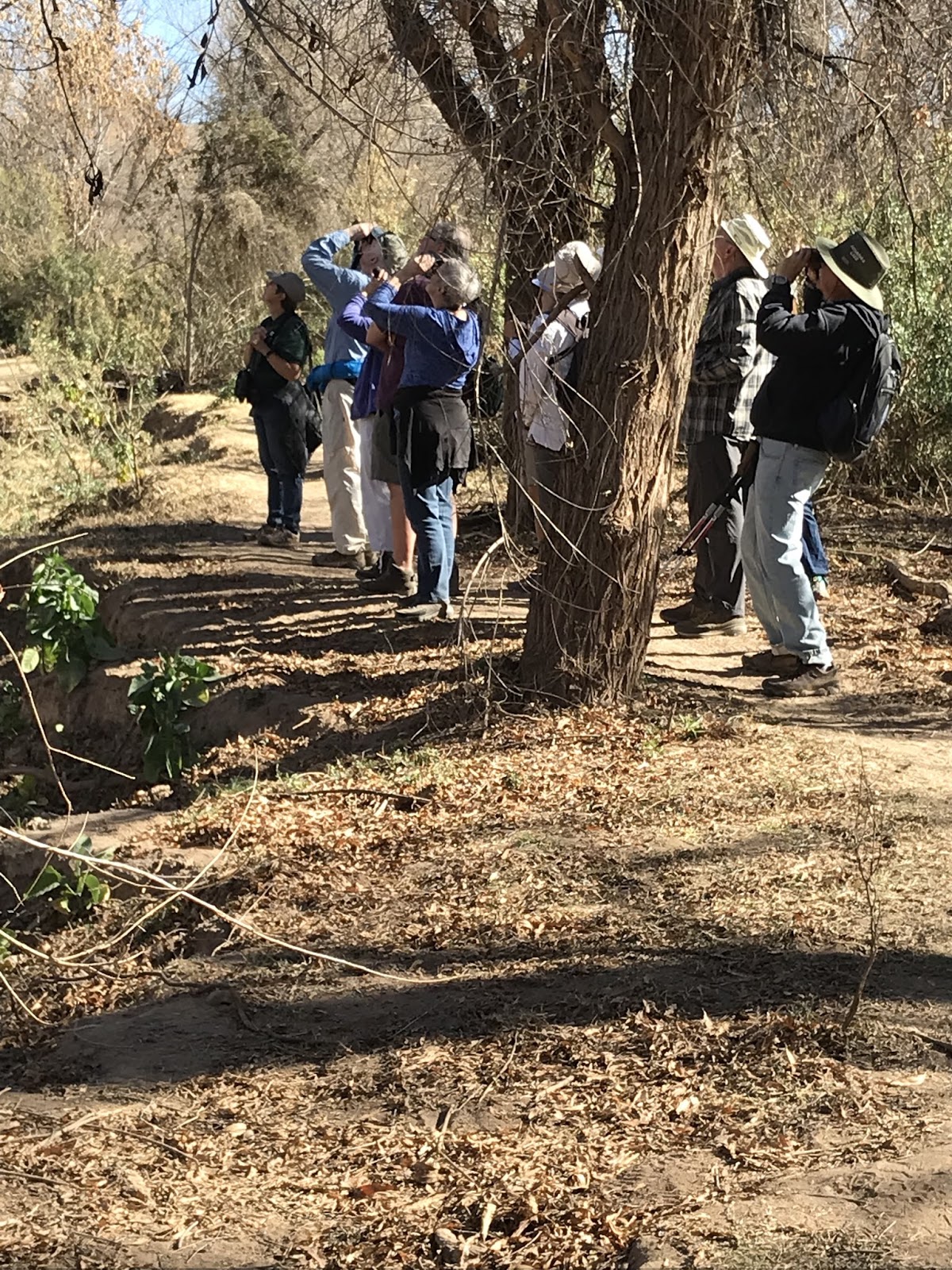
birding trail, binoculars raised on a movement in a nearby tree or shrub or fallen limb in Sonoita Creek, and get all giddy when the movement turns out to be a black-throated gray warbler, or a bridled titmouse, or a green kingfisher. And since Arizona is a free range state, birders share the Patagonia trail at times with local cows. This year there were several calves that followed their mothers down to the lake for a drink.  Between birding, doing laundry and grocery shopping in Nogales, and just sitting back to watch each day's sunset, our week at the park went by all too quickly.


We left on a rainy day and drove west to Organ Pipe National Park, 4 miles north of Lukeville, AZ. Lukeville is a border town. It was rainy at Organ Pipe, too, and the thing about a February rainy day in the desert is that it isn't very rainy at all. In Michigan we call that kind of precipitation a mist or a drizzle. What I learned is that cactus wrens warble even in the rain, but I didn't get to hear their morning sun's up song.
Organ Pipe National Park


And from Organ Pipe we drove to another favorite desert spot - Joshua Tree in southern CA. With the long President's Day weekend almost at hand, nearby LA'ers were flocking from the big city to the no-cell-service-no-flush-toilets-get-away-from-it-all campground and we were happy to find a vacant campsite that fit our rig. Piles of rocks, dark night skies, the quiet of the desert....for many, a respite from southern California 8-lane urban craziness.
Joshua Tree National Park


Thursday, February 8, 2018

Blue in Arizona

I don't think I've ever seen blue as pure as the blue sky above Portal Peak in southeastern Arizona. We spent three nights at Sunny Flat Campground near the Chiricahua Wilderness in the Coronado National Forest. The Chiricahua Wilderness is a piece of land south of the main Chiricahua National Monument, which is famous for its hoodoos, volcanic rocks that eroded in odd ways, creating tall skinny rock formations and its big boulders perfectly balanced on pedestals. We drove into Cave Creek Canyon and Sunny Flat Campground from Portal, AZ, a stone's throw from the N Mex. border.  Portal Peak stands at 8544 feet and towers over the little town of Portal. Just so you know, a scenic gravel road connects Portal to Paradise. (That seemed significant to me.)
                                    Sunny Flat Campground is 14 campsites amid stands of oaks and sycamores built around a small meadow, made miniature by the magnificent rock formations towering over it. I guess Sunny Flat got its name because by 8:30 a.m, the sun does rise above the wall of majestic rocks that enclose three sides of the campground . Across the road and south a mile, Stewart Campground is in the shadow of Cathedral Point most of the day.
During our two and a half days at Sunny Flat, we hiked 3 different trails. One was the South Fork trail, famous to birders who flock there in the spring to try to catch sight of the Elegant Trogon.


The bird eluded us, but the trail through Cave Creek Canyon was one of the most inspiring we've ever hiked. Also, while at the campground, we soaked up the delightfully warm afternoon sun (I did anyway, Michael found his shady spot) and our last afternoon there we drove the Mini to the top of a mountain on a 5 - 10 mph rocky gravel, 1 1/2- lane, twisty- turny road that  had a number of signs that looked like upside down U's.  And at the edge of the "outside" lane? Nothing.
Except the drop down into the valley which, of course, kept getting steeper and deeper as we climbed the mountain.  At the top of the mountain we found snow! Not a lot, but enough to remind
 us of winter, and make us turn around and descend to the warm sunshine.

Friday, January 26, 2018

Everything but the Pizza Delivery


And now we’re at North Padre National Lakeshore, east of Corpus Christi, campsite #6, oceanside at Malaquite Campground, facing east, overlooking the Gulf. The surf rolls and the sun shines once it burns through the morning fog. We reserved 4 nights here.

North Padre – an exercise in getting used to no power and no cell service. Our solar panels keep our batteries charged, and by the end of our first day, Michael had wired the inverter to the battery in an outside storage compartment and had run a cord inside the Siesta, so I could plug in my phone! He also ran a wire from the rooftop Wilson booster antenna to inside, so we have more cell service than we have without the booster (which is none.) So, keep that guy around and you’ll have all the amenities of urban America even when you’re off – grid (except maybe pizza delivery!)

My first morning walk on the island was white. Since the evening before, we were encased in fog. White air, whitish sand, white surf: a tunnel of whiteness. Down the beach I talked with a woman who was driving a pick-up truck on the beach. Every so often her wader-clad coworker would get out and walk out into the surf to get a water temperature. 48 degrees that day. They were working with The Aquarium in Corpus Christie as well as Sea World to release immature green sea turtles. The turtles had been picked up by boats since this cold spell set in. The cold water temperature had forced the turtles close to shore. When their bodies get too cold, they constrict and then sink and die. Rescuers brought the turtles to indoor aquariums and now will release them as soon as the water temperature rises into the 50s.

Saturday morning, after the government shut down Friday night, a ranger set out a sign by the campground bathroom which read, “This facility is officially closed.” However, the bathroom doors were left open and business was carried on as usual.  Campers were allowed to stay on and not much changed, really. Then Sunday morning two park employees came by and screwed boards across the bathroom and shower doors AND turned off the water! This caused quite a stir among the campers. The campground hosts were particularly upset that the water was off. There was a bit of a rebellious spirit that ran through the campground it seemed to me, a sort of disbelief and dismay at the ruthlessness of the National Park Service.

So, a couple of hours later, the water was restored by the park employees so campers could get water from the outside faucet.

And a couple of hours after that a certain someone with an electric drill backed 8 screws out of two boards and “freed” the bathrooms.  That certain someone had his photo taken with a campsite “Occupied” sign, as in “Occupy North Padre!” The other someone in the photo is our neighbor who camped next to us in a bright blue whimsically painted school bus lovingly named O.A.H.H – Old Age Home for Hippies. Power to the people!