Monday, September 3, 2018

Alaska Trip 2018 - Chicken to Fairbanks


Alaskan Range
Rika's Roadhouse
Tanana River
                                                                                                                               
Thursday June 21, 2018
The next leg of our journey was driving from Chicken, AK, to Tok and then northwest on the Richardson Highway (great road!) to Fairbanks. We didn’t stop in Fairbanks, just drove by to head north, knowing we would be coming back that way in a few days. We made a few stops on our way to Fairbanks, however.
On the Taylor Highway between Chicken and Tok several stops were needed for photo ops. It was a clear day, and we caught our first glimpse of the Alaskan Range, from a great distance, but there, nonetheless. Those beautiful mountain views were, I guess, the pay off for suffering through the Taylor Highway’s broken pavement, rough gravel patches, frost heaves, and pot holes!
Once on the Richardson Hwy heading for Fairbanks, we stopped at Rika’s Roadhouse State Historical Park on the Tanana River. A walking tour of the building and property helped us imagine the Roadhouse as a busy stopover for travelers from Valdez to Fairbanks in the early part of the 1900s.
That night we camped on Quartz Lake, a few miles north of Delta Junction and Rika’s Roadhouse. During the evening 3 eagles flew to the boat launch area near our RV and hung out for a while. An adult eagle kept watch from the top of a nearby spruce tree and one of the immatures strutted around on the grassy beach entertaining us. (Mosquito update: Better! Especially inside the RV.)
Sunset: 12:13 am and Sunrise: 4:13 am.
The next morning on our way to Fairbanks we stopped at the Knotty Shop, a log, burl-carved cabin gift shop with a sort of amazing display of taxidermized Alaskan animals and a separate display of ptarmigans with their summer and winter plumages. Of course, souvenirs and gifts were for sale too.
at North Pole
Christmas!
Just before reaching Fairbanks was the town of North Pole, the Santa Capital of Alaska! It was all a bit too Christmas-y for me. Michael didn’t even venture in, but I walked through the store and was mildly astounded by the amount of Christmas paraphernalia under one roof. I didn’t see Santa though.

Alaska Trip- Dawson City and Top of the World


June 20, 2018
Yes. the Klondike Highway deteriorated the further north we drove. We’d heard that would happen.  Frost heaves and patched up potholes became more and more frequent. Signs showing a horizontal zigzag indicated rough road: WW , and little orange flags warned us of impending bumps.
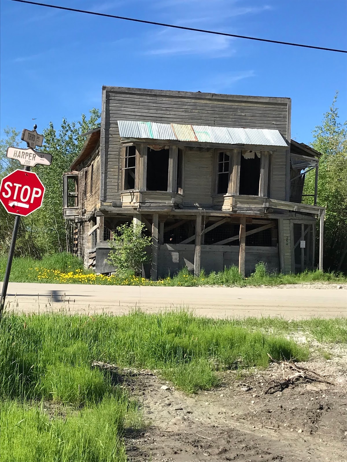
Dawson City – the Gold Mining Outpost of the Yukon and the last major town before crossing the border into Alaska. After walking around town a bit to look at a few old falling-down buildings from gold rush days as well as the newly renovated storefronts, we sat in line by the Yukon River for 2 ½ hours waiting for the free ferry to take us across. It’s not a large boat, so only 1-3 RVs can cross at a time, depending on their sizes. Motorcycles and cars must fit in with the motorhomes, too. Crossing only takes 3 minutes, but the line was LONG!
Once we were across the Yukon River, we were driving on what is known as The Top of the World Highway. It IS a “high” way – often above tree line which at that latitude is between 3 and 4 thousand feet. The highest point on the highway is near the US border at 4,100 feet. The hard-packed dirt road or at times seal coated (with pot holes and gravel breaks) runs across the tops of hills for 66 miles from Dawson City to Alaska’s border and customs, then another 13 miles to its junction with the south-running Taylor Highway which goes through the village of Chicken, AK.  In the sky, but driving defensively, with beautiful views of the Ogilvie Mountain range to the east – that’s Top of the World Highway.
The road deteriorated substantially after passing through customs at Poker Creek and re-entering the US.  Well, a newly reconstructed paved road awaited us as soon as we left the customs station. I’m talking real pavement – not seal coat - smooth and sleek with freshly painted lines – for those 13 miles mentioned above. And then it stopped. And the rough gravel, washboard -of- a -road began. The Taylor Highway south to Chicken is a narrow, winding, dirt and gravel road. Known locally as a “goat trail” it’s a 1 ½ lane gravel trail that hugs the hills, with soft shoulders, well, not really shoulders, just soft sandy gravel dropping off a thousand or so feet into the Jack Wade Creek below. And it was under construction! Through the narrowest “worst” 2 miles of it, a flag person stopped traffic and a truck led vehicles, one lane at a time. I cannot picture 2 RVs meeting each other on that stretch. After that scariest part, the road descended some and wound its way straighter along the rushing Jack Wade Creek. Until finally the tiny town of Chicken was at the bottom of the next hill.

Chicken: a local name for ptarmigan, the state bird, which is/was too hard to spell. Chicken: population: 6 in the winter, and 23 in the summer, doing their best to accommodate a growing number of summer tourists. There’s no electricity in the town except from generators, no running water, unless you dig you own well and no sewer. Using outdoor privies was norm for us as we camped through northwestern Canada so that part of Chicken wasn’t unusual. Hens and Roosters, of course, for Women and Men.

We spent the night parked at Chicken Gold Camp, home to Pedro Dredge #4, which, besides being historically important to gold mining, is now home to hundreds of swallows. These helpful birds dart about the premises eating mosquito after mosquito. That allowed us to sit outside on that beautifully warm evening and walk across the road for dinner (chicken, of course) all… bug free!!!


Top of the World Highway photos


Alaska Trip - Klondike Loop Whitehorse to Moose Creek

 June 19, 2018
“Different looking.” This stretch of the Klondike Highway, that is, in Yukon Territory (YT) driving north to Carmacs. The trees are shorter, stubbier.  The hills are tree and grass covered with rocky outcroppings.  Some of the rocks are called conglomerate or puddingstone, small pebbles cemented together by natural cement. At Whitehorse we veered off the Alaska Highway to go north on Highway 2 to Dawson City and then south into Alaska. We just can’t get enough of this far out remoteness of YT.
Totem pole in White Horse
Before veering we spent part of a morning in Whitehorse. We parked downtown by the depot and walked the river trail to the Le Dun Cultural Center where I went inside and learned a little about the generations of First Nations trappers tending their traplines. Michael and Nina stayed outside enjoying the blue sky and warm sunshine. Whitehorse is a lovely town with its cutesy storefronts, food trucks and friendly hiking/biking river trail. We could imagine living there! A local man walking his dog on the riverfront told me he lives there year-round and loves it, that in the winter it gets dark about 4pm and light about 8:30-9:00am. Well, not THAT much different from northern Michigan in December!!
 The night after Whitehorse we stayed at Moose Creek Yukon Government Campground. (Not a Provincial Park because Yukon is a Territory, not a Province.) The campground was just up the road from Moose Creek Lodge. “Lodge” is a word that took on a new meaning in this part of the world.  We might call these “lodges,” cabins, but I guess the word “lodge” denotes function more than size.  A lodge in the Yukon serves food and sometimes has a few rooms to rent and sometimes has gas/diesel. Moose Creek Lodge was busy serving food to 3 sets of customers when we stopped. The add-on back room displayed souvenirs and gifts – furs and beaded moccasins as well as coffee mugs and postcards. We bought a few bottles of water since there was no drinking water available at the campground and I thought our water pump in the Siesta sounded like the tank was getting low.
Carving in White Horse
Yes, the mosquitoes still hounded us at this campground when we were outside trying to walk, although, with our zappers, the slide-out sealed and the smelly repellents, they were not as bad inside. We slept well.
Sunset at 11:31pm. Sunrise at 4:30am.


Wild Roses by an historic Roadhouse


Moose Creek Lodge
Kitsch in front of Moose Creek Lodge


Alaska Trip, Into the Yukon -Watson Lake and West


June 18, 2018

The 323 mile stretch north and west of Fort Nelson, British Columbia, to Watson Lake, Yukon Territory, took us through the northern Canadian Rockies.  The night before reaching Watson Lake, we parked at a wayside beside the Smith River, kind of backed into the trees. Once the sun lowered and shadows lengthened, mosquitoes were everywhere! Again, we waged war with them before bedtime. We DID get some sleep – with sheets over our heads!

In the morning we escaped our mosquito haven before breakfast and found something to eat at Coal River Lodge just up the road. To get there we drove through/past a small herd of wood bison and later a couple of bears grazing near the road.

And when we arrived in Watson Lake and found an open Ace Hardware store at the edge of town, we stopped and loaded up on mosquito zappers, bug sprays, stinky coils to light and let smolder outside our door when we’re parked, and sealing tape to put around the edges of the slide-out, where Michael thinks the mosquitos are making their entry. Armed with our new weaponry, our confidence to face the northern Yukon was renewed!

What Watson Lake is famous for, besides being a welcome center to the Yukon Territory, is its Signpost Forest, a collection of 85,000 signs that has been growing since 1942. Anyone can add to the collection by stopping at the Office for a hammer and nails!


Watson Lake Signpost Forest


West of Watson Lake the Alaska Highway winds through more beautiful country with the Cassiar Mountains in British Columbia to the south and the Pelly Mountains in Yukon to the north. You can’t help but feel the vastness of the Yukon Territory as you drive these miles. Long stretched-out ascents and long, long descents down, then up and over the spruce covered hills. How many spruce trees? Countless!! Rivers run alongside the road much of the time. Coal River, Swift River, Liard River, Little Rancheria, Teslin River to name only a few. The town of Teslin is a First Nations village built on Teslin Lake – a breathtakingly beautiful setting as you approach it from higher terrain and look down on the open valley of bright blue water and dark evergreens. The newly constructed Tlingit (Klinkit) Heritage Center is in Teslin along with other Native craft outlets and a regulation curling rink. Hunting, fishing and trapping are essential livelihoods in this remote area.


Dawson Creek and the Alaska Highway


June 16, 2018
North of Jasper, Alberta, the stretch of highway #40 from Grande Cache to Grand Prairie is beautifully wooded, pristine rolling hills as you drive out of the Canadian Rockies. Pristine until you get to the planted tree farms closer to Grande Cache, where it’s still wooded, just not so pristine with interludes of stump land. But of course, there are tree farms in this northern tree-covered land. This is lumbering country. Semi-trailers stacked with logs are a presence on the road, and Grand Prairie has the feel of a working town with many wood related industries.

Once you get west of Grand Prairie, the land flattens right out to farmland.

Here’s what I wrote about our night of camping near Grand Prairie: “Saskatoon Island Provincial Park, besides being a sanctuary for birds, is also a sanctuary for mosquitoes! Last night we had our first and hopefully last night of buzzing mania. I was awake until 12:30 listening, waiting for the buzz to get closer, waiting for it to get right by me, then SWAT! At 3:30 Michael got up, turned on the light and began swatting.  Did the mosquitoes come in on Nina? We were careful last evening to keep the door closed so we’re wondering if she is the culprit.”

The day after that sleepless night, we drove into Dawson Creek. That’s British Columbia, folks! Enter the Alaskan Highway, #93. This is where it begins. 

For a stretch the road ran beside a railroad track down which a black bear meandered. We learned later that the bears find grain on the track, spilled from the grain - carrying railroad cars . 
That night, 173 miles north of Dawson Creek we camped at Buckinghorse River Wayside Provincial Park – 20 campsites along the Buckinghorse River where supposedly you can catch a grayling. While there we learned that a young grizzly had wandered through the campground the night before near campsite #1. Hmmm.

When we arrived at the campground, mid-afternoon, it was 75 and sunny. If you sat in the sun, the mosquito annoyance was low, but if you are a shade lover and once the sun started its descent and there were more shadows, GET OUT THE BUG SPRAY!!!! We slept pretty well that night, though, compared to the night before, after brushing out Nina before letting her into the RV and a fairly minor swatting episode before retiring in our foil-darkened abode. Sunset: 10:16 pm.