
June 20, 2018
Yes. the Klondike Highway deteriorated the further north we
drove. We’d heard that would happen.
Frost heaves and patched up potholes became more and more frequent.
Signs showing a horizontal zigzag indicated rough road: WW , and little
orange flags warned us of impending bumps.
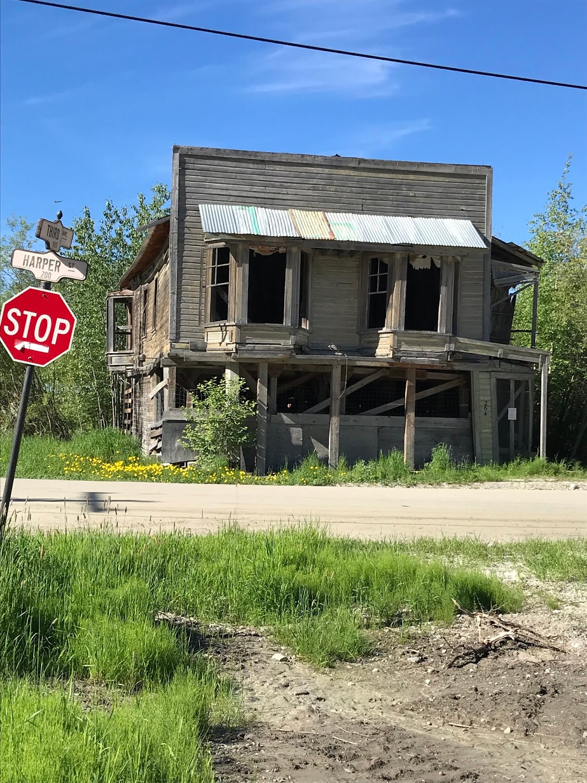 Dawson City – the Gold Mining Outpost of the Yukon and the
last major town before crossing the border into Alaska. After walking around
town a bit to look at a few old falling-down buildings from gold rush days as
well as the newly renovated storefronts, we sat in line by the Yukon River for
2 ½ hours waiting for the free ferry to take us across. It’s not a large boat,
so only 1-3 RVs can cross at a time, depending on their sizes. Motorcycles and
cars must fit in with the motorhomes, too. Crossing only takes 3 minutes, but
the line was LONG!
Dawson City – the Gold Mining Outpost of the Yukon and the
last major town before crossing the border into Alaska. After walking around
town a bit to look at a few old falling-down buildings from gold rush days as
well as the newly renovated storefronts, we sat in line by the Yukon River for
2 ½ hours waiting for the free ferry to take us across. It’s not a large boat,
so only 1-3 RVs can cross at a time, depending on their sizes. Motorcycles and
cars must fit in with the motorhomes, too. Crossing only takes 3 minutes, but
the line was LONG!
Once we were across the Yukon River, we were driving on what
is known as The Top of the World Highway. It IS a “high” way – often above tree
line which at that latitude is between 3 and 4 thousand feet. The highest point
on the highway is near the US border at 4,100 feet. The hard-packed dirt road or
at times seal coated (with pot holes and gravel breaks) runs across the tops of
hills for 66 miles from Dawson City to Alaska’s border and customs, then
another 13 miles to its junction with the south-running Taylor Highway which
goes through the village of Chicken, AK. In the sky, but driving defensively, with
beautiful views of the Ogilvie Mountain range to the east – that’s Top of the
World Highway.


 The road deteriorated substantially after passing through
customs at Poker Creek and re-entering the US. Well, a newly reconstructed paved road awaited us as soon as we left the
customs station. I’m talking real pavement – not seal coat - smooth and sleek
with freshly painted lines – for those 13 miles mentioned above. And then it
stopped. And the rough gravel, washboard -of- a -road began. The Taylor Highway
south to Chicken is a narrow, winding, dirt and gravel road. Known locally as a
“goat trail” it’s a 1 ½ lane gravel trail that hugs the hills, with soft
shoulders, well, not really shoulders, just soft sandy gravel dropping off a
thousand or so feet into the Jack Wade Creek below. And it was under
construction! Through the narrowest “worst” 2 miles of it, a flag person
stopped traffic and a truck led vehicles, one lane at a time. I cannot picture
2 RVs meeting each other on that stretch. After that scariest part, the road
descended some and wound its way straighter along the rushing Jack Wade Creek.
Until finally the tiny town of Chicken was at the bottom of the next hill.
The road deteriorated substantially after passing through
customs at Poker Creek and re-entering the US. Well, a newly reconstructed paved road awaited us as soon as we left the
customs station. I’m talking real pavement – not seal coat - smooth and sleek
with freshly painted lines – for those 13 miles mentioned above. And then it
stopped. And the rough gravel, washboard -of- a -road began. The Taylor Highway
south to Chicken is a narrow, winding, dirt and gravel road. Known locally as a
“goat trail” it’s a 1 ½ lane gravel trail that hugs the hills, with soft
shoulders, well, not really shoulders, just soft sandy gravel dropping off a
thousand or so feet into the Jack Wade Creek below. And it was under
construction! Through the narrowest “worst” 2 miles of it, a flag person
stopped traffic and a truck led vehicles, one lane at a time. I cannot picture
2 RVs meeting each other on that stretch. After that scariest part, the road
descended some and wound its way straighter along the rushing Jack Wade Creek.
Until finally the tiny town of Chicken was at the bottom of the next hill.
Chicken: a local name for ptarmigan, the state bird, which
is/was too hard to spell. Chicken: population: 6 in the winter, and 23 in the summer, doing
their best to accommodate a growing number of summer tourists. There’s no
electricity in the town except from generators, no running water, unless you
dig you own well and no sewer. Using outdoor privies was norm for us as we
camped through northwestern Canada so that
part of Chicken wasn’t unusual. Hens and Roosters, of course, for Women and
Men.
We spent the night parked at Chicken Gold Camp, home to
Pedro Dredge #4, which, besides being historically important to gold mining, is
now home to hundreds of swallows. These helpful birds dart about the premises
eating mosquito after mosquito. That allowed us to sit outside on that
beautifully warm evening and walk across the road for dinner (chicken, of
course) all… bug free!!!
 |
| Top of the World Highway photos |


No comments:
Post a Comment