Monday, February 26, 2018

Sac Town


Tower Bridge
Annie's house
It’s Monday. Tomorrow Annie will go back to work after taking a day off on either side of the weekend. That gave us 4 days together besides last weekend’s three days.

And so tomorrow we will more than likely leave, too, heading east, to begin our trek back to Michigan.  We’ll leave if we can.  It’s raining this morning in Sacramento – a good solid kind of rain – and the forecast calls for rain all day and evening.  That will mean snow in the Sierras, the mountains we have to cross on I-80 at Donner Pass, Lake Tahoe, if we want to then drive south on the eastern side of the mountain range. Which we do. Even though the miles and miles of almond, apricot and peach trees are blooming right now in the Central Valley, we have driven I-5 before and would like to take a different route. So our leaving tomorrow and going east will depend on the snow accumulation today and tonight. We shall see.

Above the American River
Annie at USGS
Our stay with Annie has been delightful.  We have visited her at the USGS office on the Sac State campus to see her work space and meet some of her colleagues, we’ve toured Old Town Sacramento, strolled through the Crocker Art Museum, and walked the dogs on the American River trail more than once. We visited two of my cousins (Mom’s sister’s family,) one of whom happens to live a few miles north of Annie in this sprawling city, and we’ve gazed with incredulous Michigan eyes on the bounty of winter vegetables and citrus at the Sunday Sacramento Farmer’s Market. We snagged a good deal on Cara Cara oranges. Of course, Michael helped Annie complete a few projects on her cute little house she’s owned for three months. Installing a garage door opener and blowing 12 inches of insulation into the attic were the two big ones on the To-Do list. Done!!

Saturday, February 17, 2018

Birds, Cacti and Rocks

    My favorite thing to do at Patagonia Lake State Park in southern Arizona is stand around on the
birding trail, binoculars raised on a movement in a nearby tree or shrub or fallen limb in Sonoita Creek, and get all giddy when the movement turns out to be a black-throated gray warbler, or a bridled titmouse, or a green kingfisher. And since Arizona is a free range state, birders share the Patagonia trail at times with local cows. This year there were several calves that followed their mothers down to the lake for a drink.  Between birding, doing laundry and grocery shopping in Nogales, and just sitting back to watch each day's sunset, our week at the park went by all too quickly.


We left on a rainy day and drove west to Organ Pipe National Park, 4 miles north of Lukeville, AZ. Lukeville is a border town. It was rainy at Organ Pipe, too, and the thing about a February rainy day in the desert is that it isn't very rainy at all. In Michigan we call that kind of precipitation a mist or a drizzle. What I learned is that cactus wrens warble even in the rain, but I didn't get to hear their morning sun's up song.
Organ Pipe National Park


And from Organ Pipe we drove to another favorite desert spot - Joshua Tree in southern CA. With the long President's Day weekend almost at hand, nearby LA'ers were flocking from the big city to the no-cell-service-no-flush-toilets-get-away-from-it-all campground and we were happy to find a vacant campsite that fit our rig. Piles of rocks, dark night skies, the quiet of the desert....for many, a respite from southern California 8-lane urban craziness.
Joshua Tree National Park


Thursday, February 8, 2018

Blue in Arizona

I don't think I've ever seen blue as pure as the blue sky above Portal Peak in southeastern Arizona. We spent three nights at Sunny Flat Campground near the Chiricahua Wilderness in the Coronado National Forest. The Chiricahua Wilderness is a piece of land south of the main Chiricahua National Monument, which is famous for its hoodoos, volcanic rocks that eroded in odd ways, creating tall skinny rock formations and its big boulders perfectly balanced on pedestals. We drove into Cave Creek Canyon and Sunny Flat Campground from Portal, AZ, a stone's throw from the N Mex. border.  Portal Peak stands at 8544 feet and towers over the little town of Portal. Just so you know, a scenic gravel road connects Portal to Paradise. (That seemed significant to me.)
                                    Sunny Flat Campground is 14 campsites amid stands of oaks and sycamores built around a small meadow, made miniature by the magnificent rock formations towering over it. I guess Sunny Flat got its name because by 8:30 a.m, the sun does rise above the wall of majestic rocks that enclose three sides of the campground . Across the road and south a mile, Stewart Campground is in the shadow of Cathedral Point most of the day.
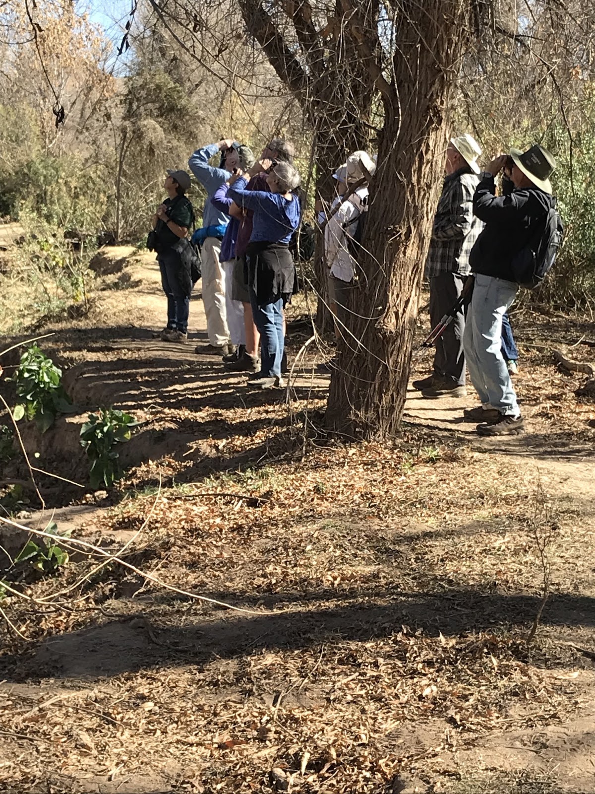
During our two and a half days at Sunny Flat, we hiked 3 different trails. One was the South Fork trail, famous to birders who flock there in the spring to try to catch sight of the Elegant Trogon.


The bird eluded us, but the trail through Cave Creek Canyon was one of the most inspiring we've ever hiked. Also, while at the campground, we soaked up the delightfully warm afternoon sun (I did anyway, Michael found his shady spot) and our last afternoon there we drove the Mini to the top of a mountain on a 5 - 10 mph rocky gravel, 1 1/2- lane, twisty- turny road that  had a number of signs that looked like upside down U's.  And at the edge of the "outside" lane? Nothing.
Except the drop down into the valley which, of course, kept getting steeper and deeper as we climbed the mountain.  At the top of the mountain we found snow! Not a lot, but enough to remind
 us of winter, and make us turn around and descend to the warm sunshine.